|
FMIS-Objectives
|
| |
- GIS Database, For entire Bihar, developed to prepare actionable flood maps
- Customized information product generated for stakeholders
- Website http://fmis.bih.nic.in/ for public dissemination of products Initiated progressive creation of Flood database to support flood management projects (more than15 yrs daily rainfall, 10 years river stage/ discharge 7 yrs inundation maps are available.)
- 3-days rainfall forecast from IMD which was earlier at 45 resolution now improved to 9 km resolution to help assess flood potential
|
|
FMISC ACTIVITIES
|
| |
- The progression of flood due to Kusaha breach was assessed at FMISC with the help of database and capacity building.
- Kusaha breach in Aug’ 2008 which was out of focus area of FMISC was successfully monitored and captured by FMISC. It is the result of capacity building after successful completion on phase-1 in June-2008
- Even in 2010, the breach at was monitored and progression of flow was predicted at FMISC, which helped the D.M.D
- FMISC after Kosi breach procured historical satellite images of the breach site location to understand the flow of river Kosi. This was provided to Kosi Breach Closure Advisory Team (KBCAT)
- Support to TAC, SRC, KHLC and GHLC in identifying vulnerable location for Anti Erosion Schemes.
|
|
Improve Knowledge Base for Flood Management |
| |
- Procurement of DEM of 1800 Sq Km in Bagmati Basin based on LIDAR survey data
- Conducting River Cross Section and Embankment Asset Survey in Bagmati –Adhwara Basin
-
Procurement of low resolution satellite data for preparation of satellite mosaic for Bihar and Processing Cartosat data for precision correction and preparation of Cartosat mosaic for Bihar
- Procurement of available hourly rainfall data from IMD
|
| |
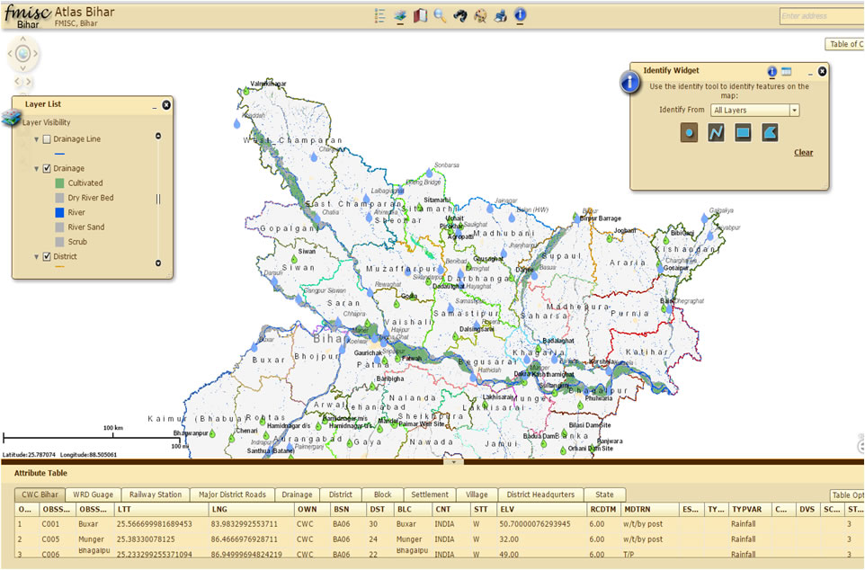
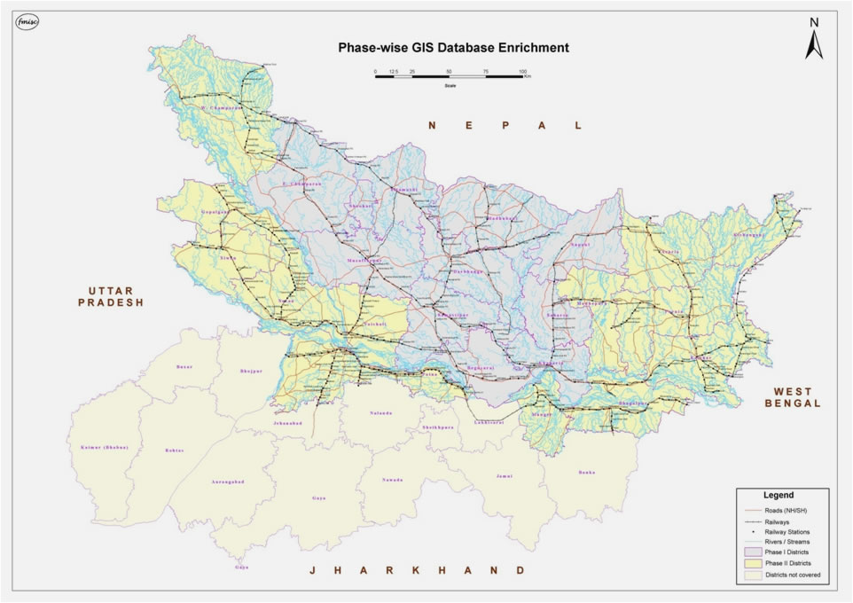
Spatial Database for Bihar |
| |
- The spatial Database for Bihar which was developed during FMISC Phase II is now being made available for online access.
|
| |
 |
| |
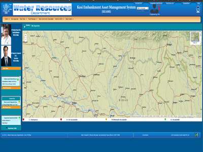
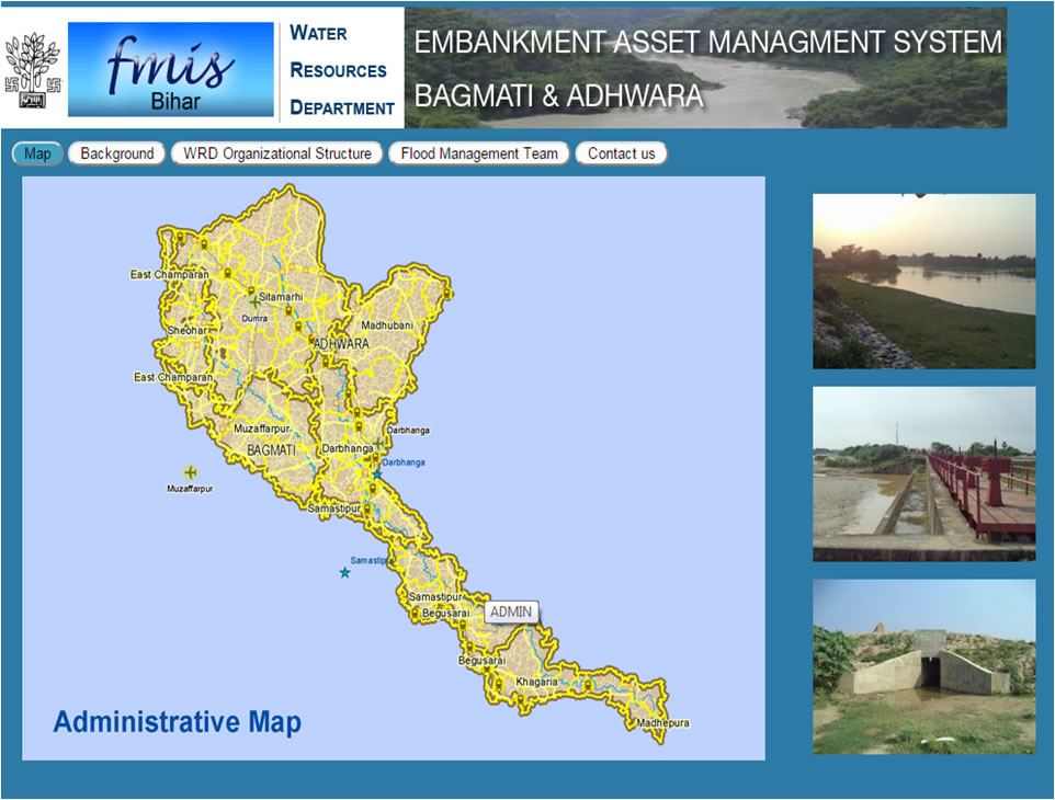
Embankment Assets Management System |
| |
- Embankment Assets Management System for Bagmati and Kosi are in the final stages of development, once complete they will provide up to date information of Embankment conditions by collecting information from department official and select community members through field data collection application and SMS.
|
| |
|
| |
|
| |
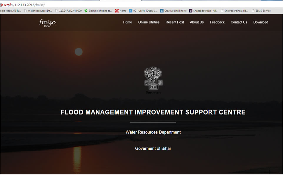
FMISC Web Site Under development http://112.133.209.6/fmisc |
| |
|
| |
 |
| |
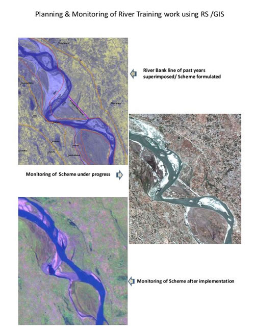
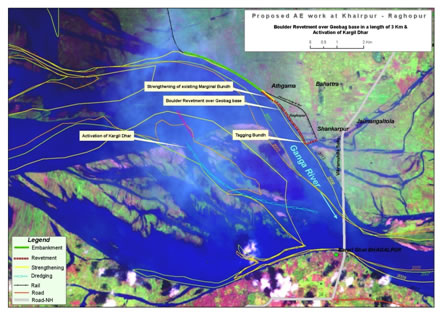
Assit in Planning and Monitoring of River Training work using RS/GIS |
| |
  |
| |
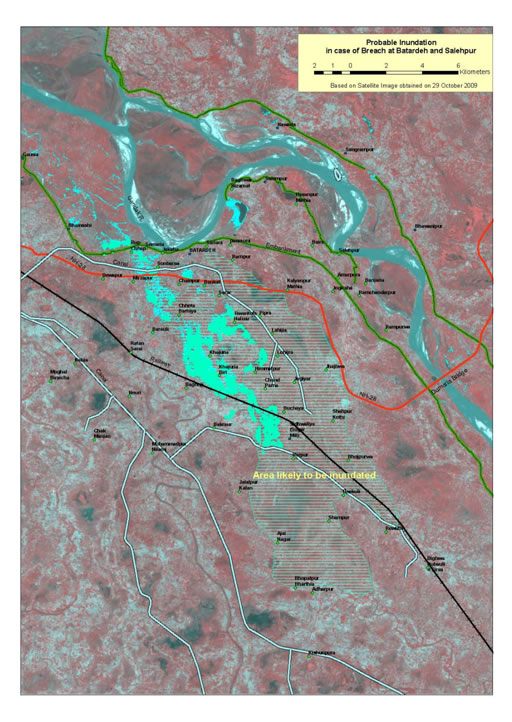
Probable Inundation in case of Breach in River Embankment |
| |
 |
| |
Information Products as Flood Risk Assessment Tools |
| |
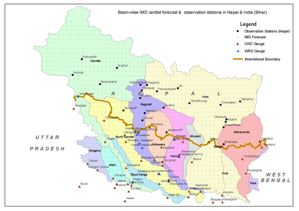
Basin Wise Rainfall Forecast |
| |
 |
| |
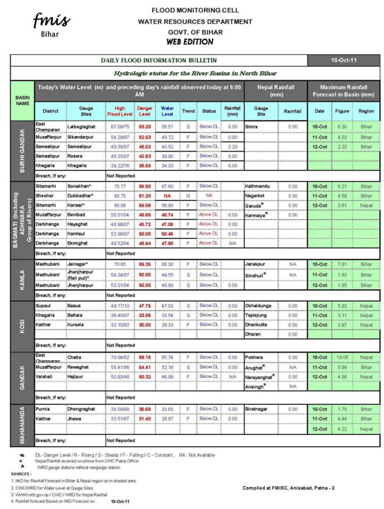
Daily Flood Bulletin |
| |
 |
| |
Sample Information Products
|
| |
 |
 |
 |
| |
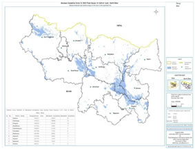
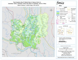
Maximum inundation map |
Flood intensity map |
Village level inundation map |
| |
 |
 |
| |
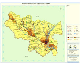
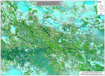
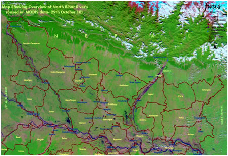
During Flood river status maps based on MODIS data |
Post Flood river status maps based on MODIS data |
| |
|
|
| |
|
|
| |
|
|
|
|
|
|